Remote sensing
Remote Sensing

https://storage.googleapis.com/remote-sensing-compassdatainc/index.html
CompassData is the world’s leader in providing GCP data for aerial photogrammetry, drone imagery, Remote Sensing data by satellites, airplanes, UAV, and other vehicles. CompassData has decades of field experience and ISO certified processes ensuring accuracy, currency, and delivers in standard format.
We Are the Experts in Ground Control Points
- Domestic and International survey
- Geodetic world-wide accuracy
- Standardized delivery formats
- ISO and FAA certified quality processes
- Cost effective GCP archive (60,000+ Worldwide)
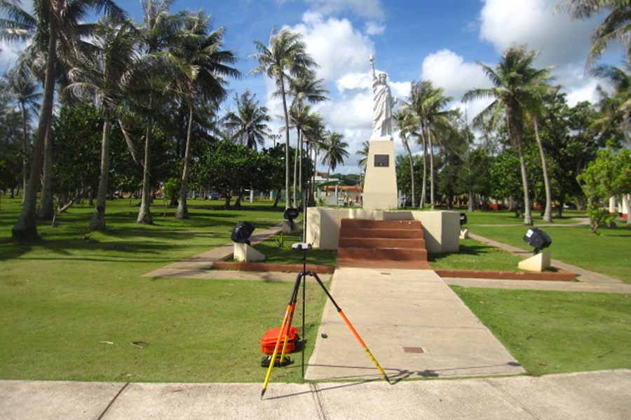
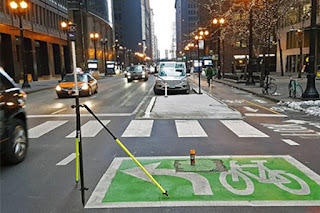
 Photo-ID GCP for LiDAR
USGS LiDAR Control
(Equals FEMA RISK Flood Mapping LiDAR Control)
Ground Control Point has to be flat or uniform in slope, ideally far away from break line and in case of Non-Vegetated Vertical Assessment Points on a hard surface.
 Paneled Survey Control
CompassData crews have installed and painted
Photogrammetric panels in various shapes and sizes across
the world.
Coordination with customers to install panels in the correct size and in time before the aerial acquisition is standard.

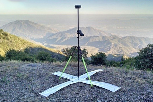
Photo-ID for Imagery
Ground Control Point collection suitable for Satellite and Aerial Imagery in Italy, before traveling north to survey GCPs in Switzerland, Germany, Denmark, and Sweden.
A Europe-wide project including 16 full countries and parts of 3 Scandinavian countries. The surveyor in the photo records a static GNSS observation in a remote Italian town in the Alps.
 Photo-ID GCP for LiDAR
USGS LiDAR Control
(Equals FEMA RISK Flood Mapping LiDAR Control)
Ground Control Point has to be flat or uniform in slope, ideally far away from break line and in case of Non-Vegetated Vertical Assessment Points on a hard surface.
 Paneled Survey Control
CompassData crews have installed and painted
Photogrammetric panels in various shapes and sizes across
the world.
Coordination with customers to install panels in the correct size and in time before the aerial acquisition is standard.
Photo-ID for Imagery
Ground Control Point collection suitable for Satellite and Aerial Imagery in Italy, before traveling north to survey GCPs in Switzerland, Germany, Denmark, and Sweden.
A Europe-wide project including 16 full countries and parts of 3 Scandinavian countries. The surveyor in the photo records a static GNSS observation in a remote Italian town in the Alps.
Photo-ID GCP for LiDAR
USGS LiDAR Control
(Equals FEMA RISK Flood Mapping LiDAR Control)
Ground Control Point has to be flat or uniform in slope, ideally far away from break line and in case of Non-Vegetated Vertical Assessment Points on a hard surface.
CompassData’s Excellence
Per ISO and FAA Certified Quality Processes,
CompassData strives to meet and exceed the customers' project requirements:
- Satellite imagery
- Nadir and oblique aerial imagery
- Frame cameras, push broom cameras, drone imagery
- Mobile mapping sensors
- LiDAR dataset
- Image Orthorectification
- LiDAR and 3D Models
- UAV based Sensors
- Airport Mapping Databases
- Surface Elevation Mapping
- Sensor Calibration
- Driverless Vehicle Navigation
- Planimetric (GIS) Mapping
- Urban Planning / Engineering
- Utility Mapping
- Consulting our customers to find their best solution
- Get link
- X
- Other Apps

Comments
Post a Comment