What are Ground Control Points

Some Ground Control Point Facts
1. A ground control point (GCP) is a marked point on the ground that has a known location in terms of latitude, longitude, and elevation.
2. GCPs are used to improve the accuracy of a geospatial dataset.
3. They are typically placed at strategic locations throughout the area of interest.
4. GCPs can be collected using GPS or total station surveys.
5. A minimum of 3 GCPs is needed to improve the accuracy of a dataset.
6. GCPs can be used to correct for errors in satellite imagery, LiDAR data, and other geospatial data.
7. They can also be used to create more accurate 3D models of an area.
8. GCPs are often used in construction, surveying, and mapping applications.
9. The accuracy of a GCP is typically within 1 meter.
1. There are 3 types of ground control points (GCPs):
2. 1. Passive GCPs are natural or man-made features with known locations that can be identified in images.
3. 2. Active GCPs are features with known locations that emit a signal that can be detected by the sensor.
4. 3. Virtual GCPs are features with known locations that are generated by photogrammetric software.
5. GCPs are used to improve the accuracy of drones and ensure that the images captured are correctly georeferenced.
6. The average accuracy of a drone without GCPs is about 3.5 meters.
7. The average accuracy of a drone with GCPs is about 1.5 meters.
8. GCPs can improve the accuracy of a drone by up to 2 meters.
1. What is the purpose of a ground control point?
A ground control point (GCP) is a point on the ground whose location has been determined through surveying or other means and whose position is known with a high degree of accuracy. GCPs are used to provide a common reference for the control of surveying, mapping, and photogrammetric operations. They are also used to check the accuracy of measurements made from the air or space.
2. How is a ground control point typically established?
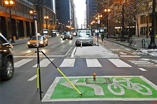
A ground control point (GCP) is typically established by surveying the location with GPS equipment and then marking the spot with a physical marker. The GPS equipment is used to determine the precise location of the GCP, and the physical marker is used to identify the location of the GCP to people on the ground.
3. How does the use of ground control points impact the accuracy of a survey?
The use of ground control points (GCPs) is a common practice in surveying and is typically used to increase the accuracy of measurements. When GCPs are used, the surveyor first establishes the location of the GCPs and then uses these points to help control the measurements taken during the survey. The use of GCPs can impact the accuracy of a survey in a number of ways.
4. How many ground control points are typically used in a survey?
There is no definitive answer to this question as the number of ground control points (GCPs) used in a survey can vary depending on a number of factors, such as the size and complexity of the area being surveyed, the desired accuracy of the survey, and the available resources. In general, however, it is common to use between 3 and 10 GCPs in a survey.
5. What is the minimum distance that should be between two ground control points?
There is no definitive answer to this question as it will vary depending on the specific application and project requirements. However, as a general rule of thumb, the minimum distance between two ground control points should be at least 10 times the height of the tallest object in the project area. This will ensure that the ground control points are sufficiently far apart to provide an accurate and reliable control network.
6. How are ground control points typically marked?
There is no one answer to this question as the marking of ground control points (GCPs) can vary depending on the specific project requirements. However, there are some common methods that are typically used to mark GCPs. These include painting or flagging the ground, using GPS units to mark the location, or using physical markers (e.g. metal rods or survey monuments).
7. How long do ground control points typically remain in place?
Ground control points (GCPs) are typically placed prior to the start of data collection and remain in place until after the data collection has been completed. The length of time that GCPs remain in place varies depending on the project requirements and the type of data being collected.
8. How often should ground control points be checked?
There is no definitive answer to this question as it will depend on a number of factors, including the specific project requirements, the accuracy of the GPS equipment being used, the terrain, and the weather conditions. In general, however, it is generally recommended that ground control points be checked at least once every 24 hours.
9. What are the consequences of not using ground control points?
If you are not using ground control points (GCPs), you are essentially flying blind. The consequences of this can be disastrous, as you have no way to ensure that your images are properly aligned, or that you are collecting accurate data. Without GCPs, you also have no way to create an accurate 3D model of your project area. In short, not using GCPs will severely limit the accuracy and usefulness of your data.
10. Can ground control points be used in conjunction with other surveying methods?
Yes, ground control points (GCPs) can be used in conjunction with other surveying methods. For example, GCPs can be used to control the vertical datum of a project, or to establish horizontal control for a photogrammetric mapping project. When used in conjunction with GPS, GCPs can provide an extremely accurate control network.
1. How are ground control points used in surveying?
Ground control points are used to establish a horizontal and/or vertical datum for a survey. They are also used to control the accuracy of the survey by providing known reference points. The use of ground control points depends on the type of surveying being done. In plane surveying, horizontal control is established by establishing a base line and measuring angles to other lines from the base. Vertical control is established by measuring elevation differences from a benchmark.
2. How are ground control points established?
There are a few ways to establish ground control points (GCPs), but the most common is through the use of GPS. GPS is a satellite-based navigation system that can provide accurate location information for a user on the ground. By using a GPS receiver, surveyors can collect data points that can be used to establish GCPs. Another common method for establishing GCPs is through the use of aerial photography.
3. How are ground control points marked?
Ground control points (GCPs) are marked in a variety of ways, depending on the terrain and the desired level of precision. In open, level terrain, GCPs are often simply marked with a brightly colored flag or stake. In more rugged terrain, GCPs may be marked with a cairn of stones, or a metal or plastic marker embedded in the ground.
4. How many ground control points are needed for a surveying project?
The number of ground control points (GCPs) needed for a surveying project depends on a number of factors, including the size and complexity of the project, the accuracy required, the terrain, and the availability of GCPs. In general, more GCPs are needed for larger, more complex projects, and for projects where higher accuracy is required.
1. Who is responsible for establishing ground control points?
There is no definitive answer to this question as there is no one specific entity or organization that is responsible for establishing ground control points (GCPs). Depending on the specific project or application, GCPs may be established by surveyors, engineers, or other professionals using a variety of methods. In some cases, GCPs may be established by govern
2. Who is responsible for maintaining ground control points?
There is no definitive answer to this question as it can vary depending on the specific location and situation. In general though, whoever is responsible for the overall management of the ground control points (GCPs) would be the ones responsible for their maintenance. This could be a government agency, private company, or even an individual depending on the case.
3. Who uses ground control points?
Ground control points are used in surveying and mapping to establish horizontal and/or vertical control for an area. They are generally established using GPS or other surveying equipment and then marked on the ground with some sort of physical marker, such as a stake, rebar, or monument. Once established, other surveyors or mapping crews can then use the ground control points to help establish control for their own projects in the area.
4. Who needs to be consulted when establishing ground control points?
There are a few different types of ground control points (GCPs), and each type requires different people to be consulted: 1. Horizontal GCPs: These are typically used to control the horizontal positioning of features on a map. They can be established using GPS, leveling, or triangulation. When using GPS, you will need to consult with a qualified surveyor. When using leveling or triangulation, you will need to consult with a qualified engineer.

Comments
Post a Comment